This interjurisdictional effort was coordinated by the Forum for the Conservation of the Patagonian Sea and Areas of Influence, the Ministry of Tourism and Protected Areas, the Secretariat of Environment and Control of Sustainable Development, the Secretariat of Fisheries and the National Parks Administration, within the framework of the “MaRes Project, to strengthen the resilience of coastal and marine protected areas in Argentina”, an initiative financed by the European Union.
The aerial surveys, authorized by the Ministry of Tourism and Protected Areas of Chubut and the National Parks Administration, were conducted in two stages. The first covered the Península Valdés Natural Protected Area and the second the Southern Patagonia Interjurisdictional Coastal Marine Park and part of the provincial coast. The activity was implemented by the technical teams of the province of Chubut, the National Parks Administration, the Whale Conservation Institute and the CCT CONICET- CENPAT, within the framework of the Component Reduction of plastic fishing waste and promotion of the circular economy of the MaRes Project.
“From the Undersecretariat of Conservation and Protected Areas, we consider these flights to be a very valuable resource for decision making. They allow us to identify, along our entire coast and especially in our protected areas, the most affected and critical points”, said Nadia Bravo, Undersecretary of Conservation and Protected Areas of the Ministry of Tourism and Protected Areas of Chubut.
She added that the information obtained is essential to coordinate actions with other agencies and plan strategic cleanups, always respecting the faunal calendar. “Our objective is to protect and conserve the biodiversity of our region. As the enforcement authority in protected areas, we deeply value this joint work with the MaRes Project and celebrate these advances.”
This inter-institutional initiative will make it possible to comprehensively assess the dynamics of plastic waste of fishing origin and identify the sites of accumulation and their degrees of impact, along the entire Chubut coast. The information will be complemented with analysis of ocean currents, satellite images and will include the cadastre map of coastal fields, which will allow the authorities to organize and optimize beach cleaning and remediation actions, as well as to evaluate the accessibility to different sites with varying degrees of impact.
In addition, the analysis of results will make it possible to determine the effectiveness and identify possible improvements in measures aimed at strengthening waste management on ships and in ports. In this way, the Forum for the Conservation of the Patagonian Sea through the “Mares Project” contributes to the protection and conservation of these vital ecosystems for the health of the oceans.
SURVEY DEVELOPMENT
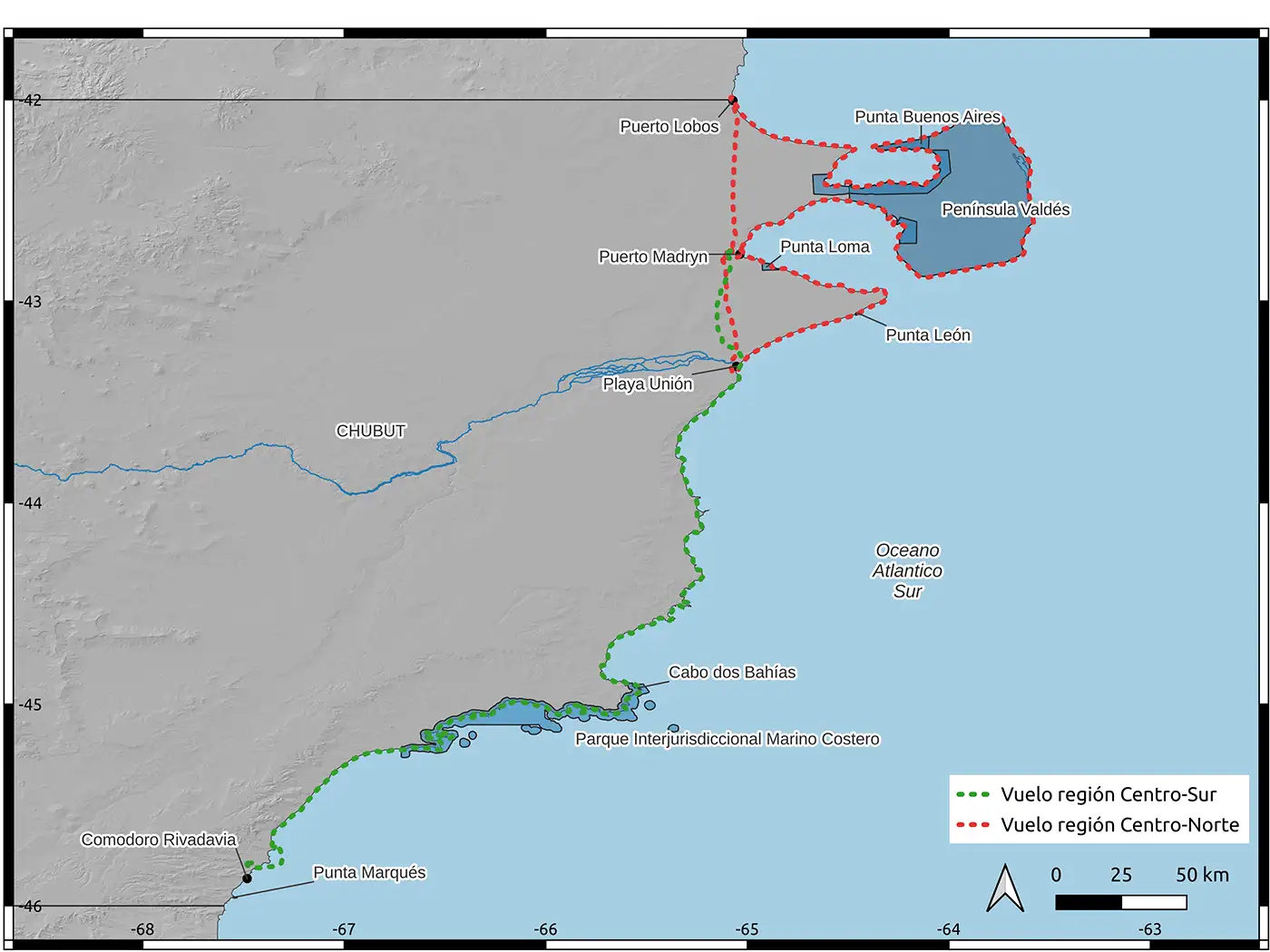
In order to complete the entire coast of Chubut, each aerial survey was carried out in two stages: center-north and center-south.
Stage 1: Center-North Zone
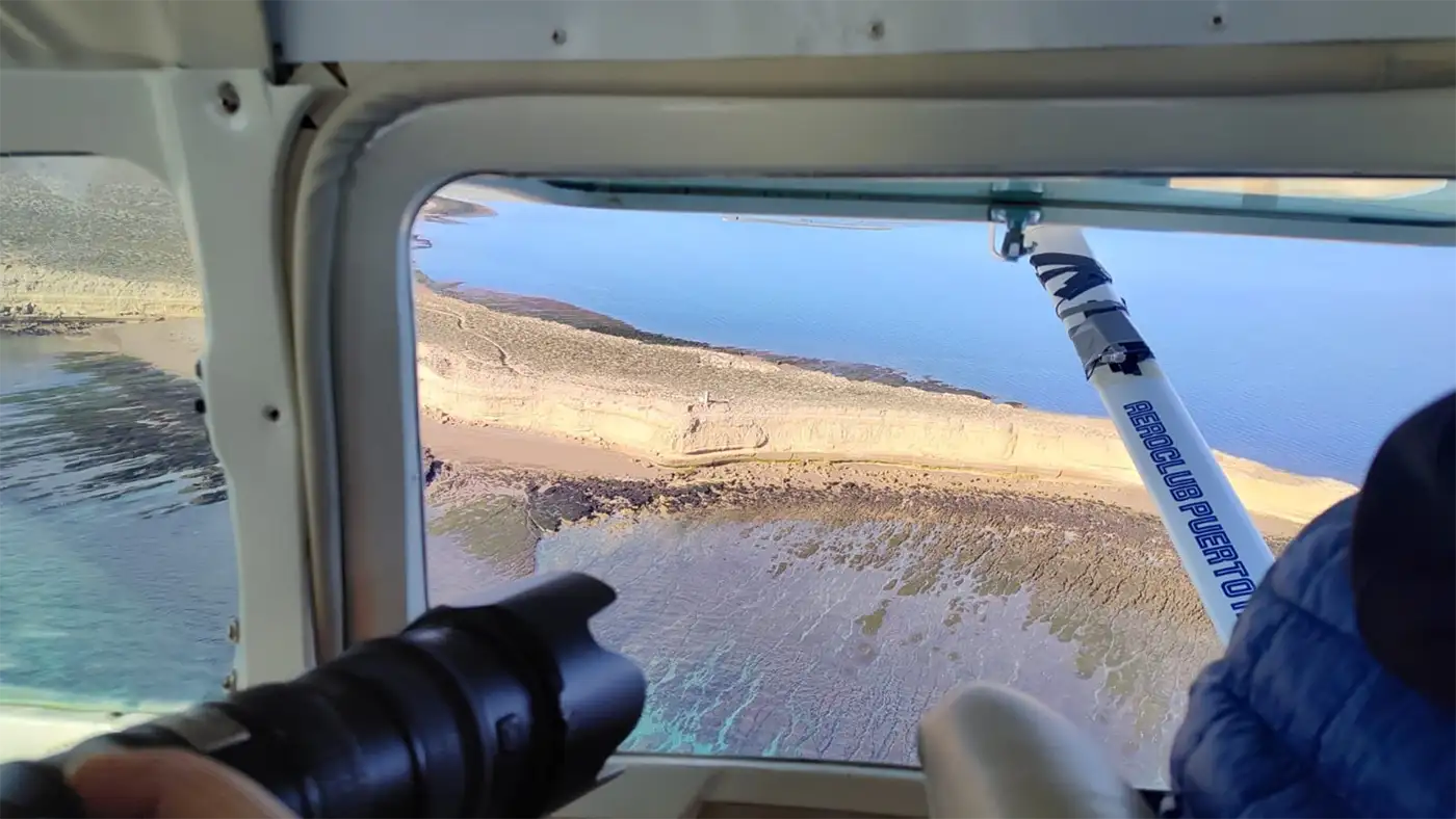
The first stage of the survey was carried out from Playa Unión to Puerto Lobos, covering the entire Península Valdés Natural Protected Area. Starting from the Puerto Madryn aeroclub, the survey began at the mouth of the Chubut River, continuing north towards Playa Unión, including Punta Ninfas, Golfo Nuevo, the outer coast of Península Valdés, Golfo San José and from Punta Quiroga to Puerto Lobos (border with Río Negro).
Stage 2: Central – South Zone
The second stage covered the Chubut coast south of Rawson, including the Southern Patagonia Interjurisdictional Coastal Marine Park (PIMCPA), up to Comodoro Rivadavia. Departing from Puerto Madryn to Comodoro Rivadavia, we flew along the continental coast from Comodoro to Playa Unión and some islands near the mainland, covering a total of 1,329 km of the Chubut coast, between the two flights.
“This survey is essential to understand the magnitude of plastic pollution in key areas for the conservation of marine biodiversity. The information revealed allows us to more accurately target cleanup and remediation actions with the least impact on biodiversity,” says Juan Duro, Intendant of the Southern Patagonia Interjurisdictional Coastal Marine Park.
He adds, “These are sensitive areas that are often difficult to access. This interjurisdictional effort reinforces our commitment to the protection and conservation of Argentina’s coastal and marine ecosystems.”
WHERE THEY COME FROM AND WHERE THEY ARE GOING
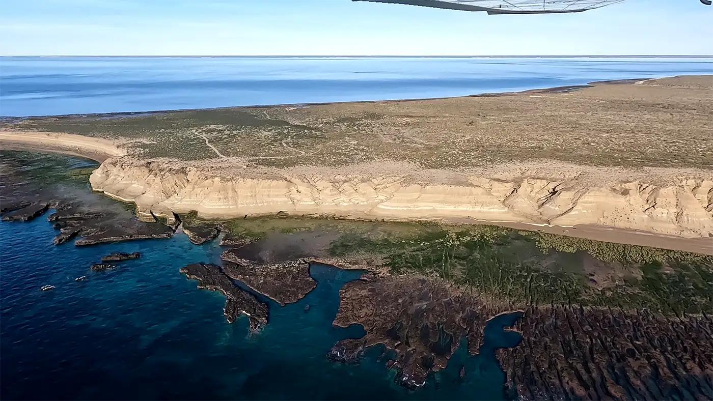
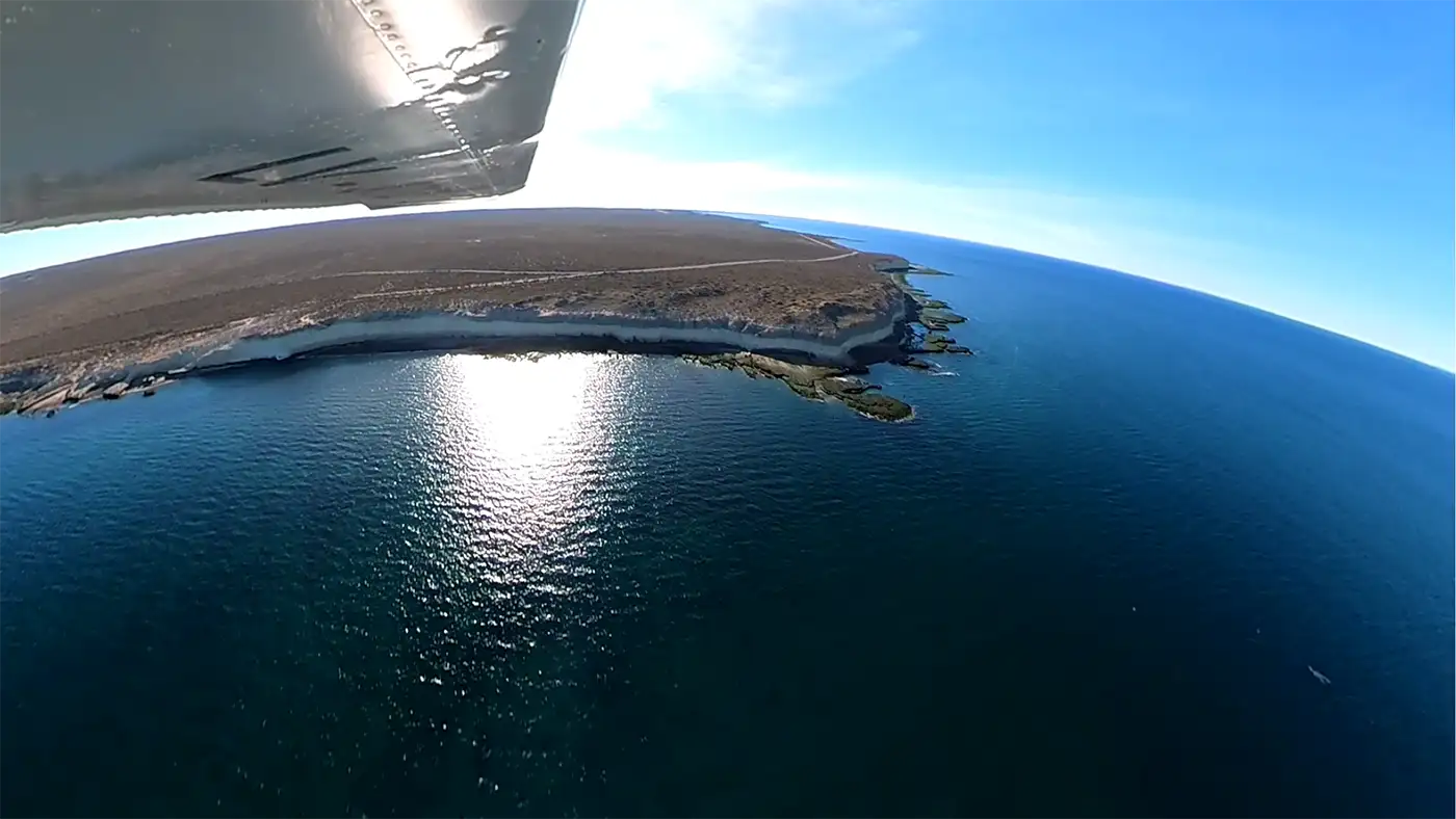
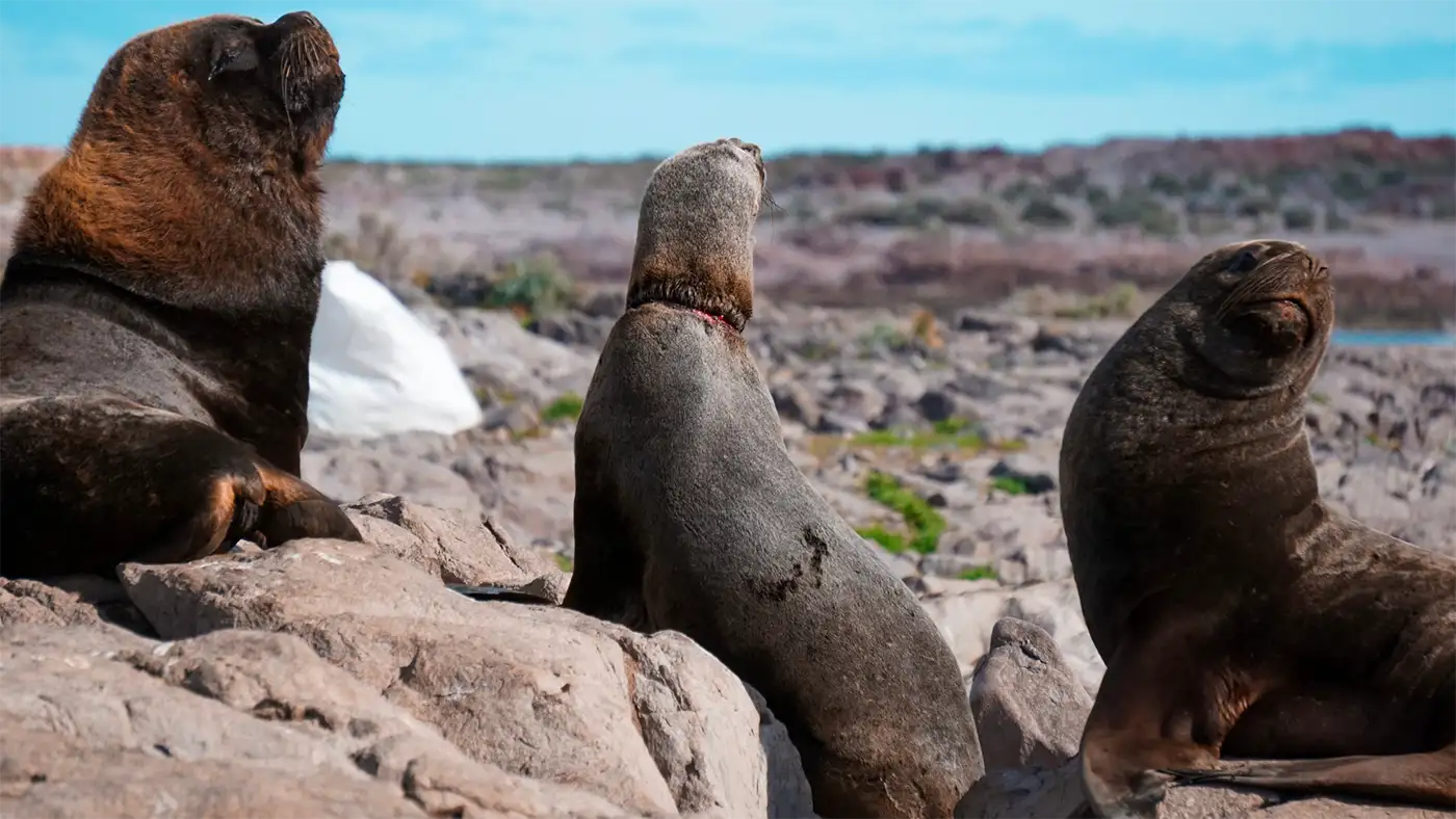
Aerial surveys help to dimension the problems and restoration possibilities in impacted sites. They make it possible to analyze the history of the origin of plastics, where they are generated, their route and destination, especially in those areas that can only be accessed by air.
This input is related to other sources of data such as the survey and cleaning work that the province of Chubut has been carrying out through the Secretariat of Environment and Control of Sustainable Development, those produced in ongoing scientific-technical approaches, linked to research that analyzes the origin and sources of the problem through oceanographic simulation of marine currents, fish box detection studies through artificial intelligence using drone transects and the detection of accumulation sites through satellite images.
“From the Secretariat of Environment, specifically through the Directorate of Environmental Programs, we actively collaborate in the aerial survey of the coasts of Chubut. This information is crucial for us, as we use it to process and determine specific actions in different areas. Previous flights have shown us that this tool, by allowing us to cover much larger areas and distances than a land survey, is indispensable to evaluate, quantify and prioritize the measures to be taken. The aerial survey is, without a doubt, of priority interest and a fundamental tool in waste management on the coasts of Chubut”, says Fernando Pegoraro, Secretary of the Secretariat of Environment and Control of Sustainable Development of Chubut.
COMMITMENT TO MARINE CONSERVATION
Our coasts and seas are seriously threatened by the accumulation of plastics and other waste, all originated by human activity. Therefore, a collective commitment to reduce these impacts through research, science and management is a key contribution to meeting conservation goals both locally and globally. Each advance brings us closer to effective solutions to reduce pollution, biodiversity loss and the effects of climate change, and thus protect marine ecosystems and life in all its forms.